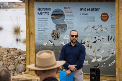
Greg Ryan at the bird hide sited next to the 10-hectare wetland habitat area.
Waikato Regional Council’s newly completed asset rationalisation project near the Piako River mouth reflects a new and environmentally innovative era of flood management.
The three-year project, which saw three floodgates decommissioned and replaced with one, was an upgrade of the lower reaches of the Piako River scheme that was built in the 1960s and 1970s to provide protection to 159,000 hectares of low-lying – including below sea level – productive farmland.
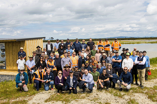
An official opening of the new floodgate, which was attended by representatives from iwi, landowners, contractors, Hauraki District Council, Pūkorokoro Miranda Shorebird Centre and the Ministry for Business, Innovation and Employment, was held on Monday 23 October 2024.
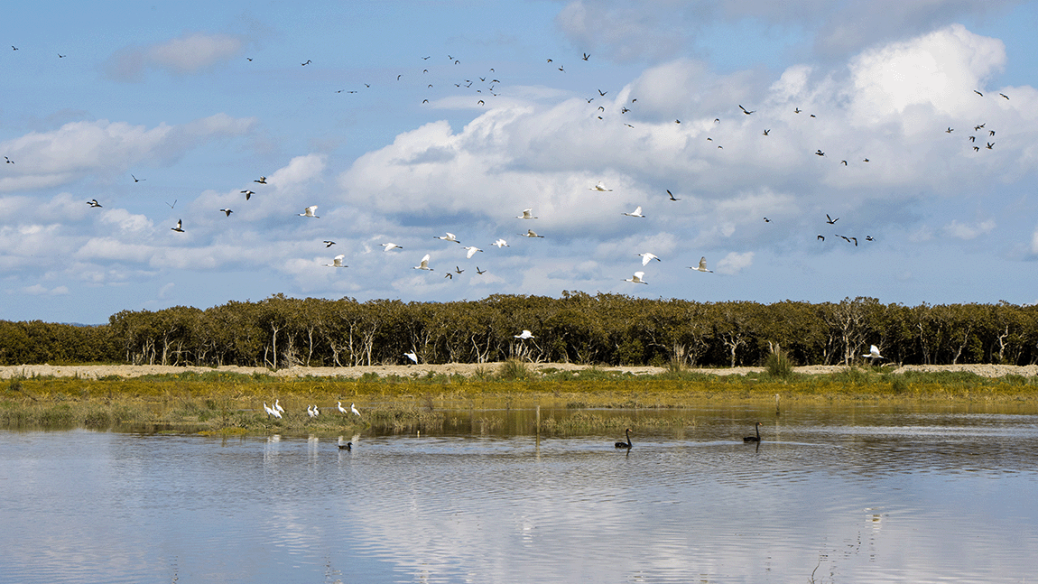
Integrated Catchment Management director Greg Ryan says the upgrade includes a number of positive environmental outcomes through innovative engineering, including reduced sediment loads to the Piako River, deep water refuges for aquatic wildlife, safe fish passage for tuna/eels and a new 10-hectare habitat for resident and migratory shorebirds.
“When the Piako River flood protection scheme was built, the focus was solely on enabling farming,” says Ryan.
“At that time, the environmental issues we’re seeing now, such as high sediment loads in the waterways, habitat loss and obstructions to fish passage, did not exist, nor were they even considered as being a possible impact on our environment.
“But now, as we start to replace this aged infrastructure, we’re looking to achieve better outcomes all round. That means making sure our service level for flood protection can continue to be met with climate change, that we can keep our maintenance and operational costs down by combining several old assets into one, and that we’re doing it in a way that also improves the health and wellbeing of freshwater ecosystems and habitats.”
The new floodgate provides flood protection for 829 hectares of land over the next 100 years, with options for increased protection into the future.
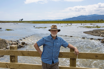
Project manager Grant Ockleston in front of the wetland habitat area, which fills and empties with the tide.
Project manager Grant Ockleston, director of Project Lab NZ, says there were a number of issues that had to be considered in its design. They included:
- the sediment load of the Piako River, which blocks floodgates during periods of low rainfall and prevents fish passage, and encourages mangrove growth
- river channel migration, about 50-75 centimetres a year towards the project site, due to mangrove encroachment on the opposite bank
- erosion at channel outlets and along the riverbank
- stopbanks in need of repair and protection from the tide, particularly from king tides during extreme weather events
- a need for a safe high-tide roost and foraging habitat for migratory and resident shorebirds, which had moved onto the project site due to mangrove encroachment on the tidal flats of the Firth of Thames
- a drainage network too small to deliver water from the catchment to a single floodgate
- a low-lying catchment, so limited hydraulic head to achieve level of service.
“There was a lot of thought put into this project,” says Ockleston.
“Every site is unique, so the concept is specific to the site. We engineered multiple ways of resolving the problems, so that we can be confident they will no longer be an issue.”
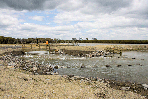
The new floodgate has been set back from the river by 69 metres to accommodate the potential for river channel shift, with the discharge channel naturally angled to enter the Piako River to prevent channel erosion.
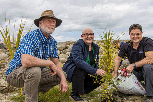
“The nature of the mangroves on the other side means the river channel is moving towards our stopbanks, so the solution was to create a buffer zone with riparian planting between the river’s edge and our infrastructure.”
A 24/7 flushing mechanism, which allows fish passage, has been designed to stop river sediment deposition in front of the floodgate, while a deep pond built at the floodgate inlet is designed to capture more than 90 per cent of the sediment from water in the catchment prior to discharge into the river – and provide refuge for tuna/eels, even during times of drought.
“The pond was designed to improve water quality going into the Piako River and the Firth of Thames. It was built in a U-shape, with internal berms and a causeway, so the council can easily excavate the sediment that gets captured in there and store it for future stopbank upgrades.”
Should a pump station be required at this site in the future, the pond also provides enough start-up water volume for a pumping operation.
“With the storage pond and the new high capacity drainage network, all the water in the catchment can now be cleared in 24 hours – with the old structures, that took three days.”
The floodgate flaps have been hung further from the wall to allow fish passage during the early stages of the tide cycle.
A tidal control structure that allows the newly created saltwater wetland habitat to become regularly inundated with the incoming tide, also allows fish passage and includes a floating boom with a submerged screen to restrict mangrove seeds from entering and growing in the area.
“Fish will defintely go in and out of the site, and so will eels,” says Ockleston. “Small invertebrates and worms and the like will inhabit the site, providing food for shorebirds, but the primary reason we have created this wetland is so the shorebirds have a safe place to roost. We created an island roost of about 5000 square metres, which is large enough to support the entire population of shorebirds in the Firth of Thames.”
The wetland habitat area is next to the Hauraki Rail Trail between Kaiaua and Thames. A bird hide with information panels about shorebirds and the project has been installed next to the stopbank on which part of the cycle trail is built.
Waikato Regional Council Chair Pamela Storey says the project would not have been possible without the support of the many stakeholders involved.
“It has been a true partnership, with funding for the infrastructure provided by central government, the New Zealand Lottery Commission, and Hauraki District Council.”
Pūkorokoro Miranda Shorebird Centre, iwi and landowners also helped with development planning for the wetland habitat area.
“This project is a true demonstration of the multiple outcomes that can be achieved by working together.”
The council received $2.638 million from the Government’s Climate Resilience Programme, which is administered by Kānoa Regional Economic Development and Investment, $250,000 from the New Zealand Lottery Commission’s Environment and Heritage Fund, and $35,000 from Hauraki District Council towards changes to the drainage network.



To ask for help or report a problem, contact us
Tell us how we can improve the information on this page. (optional)