Studies open door to Mercury Islands underwater world
| Published: | 19/12/2024 |
Newly published research has provided rare insights into the reefs and habitats around the Mercury Islands, a group of islands northeast of Whitianga.
Commissioned by Waikato Regional Council, the two-pronged study was carried out by researchers at the University of Auckland.
Waikato Regional Council is responsible for management of the coastal marine area which extends 12 nautical miles off the Waikato region coastline and includes the Mercury Islands group.
The first part of the study involved a survey by divers during 2021 and 2022 of nine sites on the reefs off the coast of the Mercury Islands group. At each site, divers swam along a fixed line running from the low tide height to the bottom of the reef or a maximum of 15m depth. Along the way they recorded aspects of the habitat such as the presence of kelp or other algae, areas dominated by sponges and areas overgrazed by kina (the common sea urchin). In addition, targeted surveys at seven sites recorded the abundance and size of key reef animals including reef fish, crayfish and the long-spined sea urchin (Centrostephanus rodgersii).
The second part of the study used drop camera photos and satellite imagery to map the habitat types present in shallow waters (<20 m) around the islands. Some 1558 hectares of shallow marine habitats were mapped.
“Despite the popularity of the Mercury Islands with boaties, fishers and divers, the underwater habitats of these islands have been relatively unstudied,” said Associate Professor Nick Shears, lead author, University of Auckland.
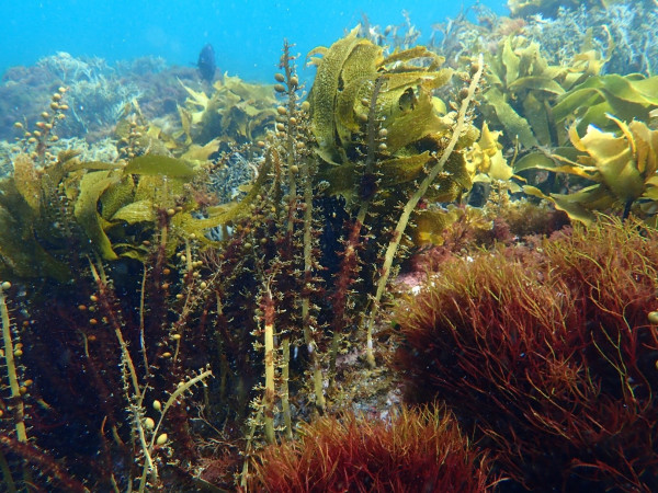
“Our surveys revealed extensive and complex underwater reef systems that are characterised by a diverse array of habitat types and occupied by mostly warm water species typical of northern offshore islands, but also a few cooler water species.
“Though largely healthy with abundant macroalgal forests, the rocky reef ecosystems of the Mercury Islands, face significant pressures from fishing, evidenced by the low abundance and small sizes of key predators like snapper and crayfish.
“This first comprehensive survey highlights the need for better understanding of reef biodiversity and health to guide marine management and spatial planning in the region."
The diver-survey found that overall, the reef communities around the Mercury Islands appear to be healthy, with no invasive species detected (although Caulerpa has since been detected at Great Mercury Island) and abundant and diverse seaweed forests covering much of the area.
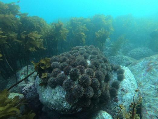
The signs of heavy fishing were evident, with few large fish and crayfish recorded. In addition, the presence of reef areas overgrazed by kina, known as “kina barrens”, are an indicator of the impacts of fishing on reef ecosystems.
The mapping study produced, overall, a clear picture of the broad-scale distribution of different habitat types in shallow water around the Mercury Islands. Comparisons with other images suggest that these patterns have remained stable for at least the last decade. The study noted the limitations of the method, including map accuracy affected by varying water quality and sea conditions.
“These surveys are the most comprehensive study we now have looking at the biodiversity and habitats of these islands. This provides a valuable reference for future marine management of the Mercury Islands,” said Waikato Regional Council Coastal Science Team Leader Dr Michael Townsend.
“The use of satellite imagery combined with drop camera observations is a cost-effective way to better understand the different habitat types in these shallow waters.”
Read the reports online

Beds of mixed algae provide a habitat for other reef species. Photo: Nick Shears, University of Auckland.

Dense kina clusters amongst Ecklonia radiata kelp forests on boulders at 10m depth. Photo: Nick Shears, University of Auckland.


To ask for help or report a problem, contact us
Tell us how we can improve the information on this page. (optional)